You asked for this one. A lot of you asked for this one.
Open the map over a busy part of your selected region and you get a wall of black pins. Every well in the area, all at once, whether or not it has anything to do with the job you are driving to. Our customers have been telling us the same thing since launch: I only care about a few of these. Let me hide the rest.
Starting this week, you can.
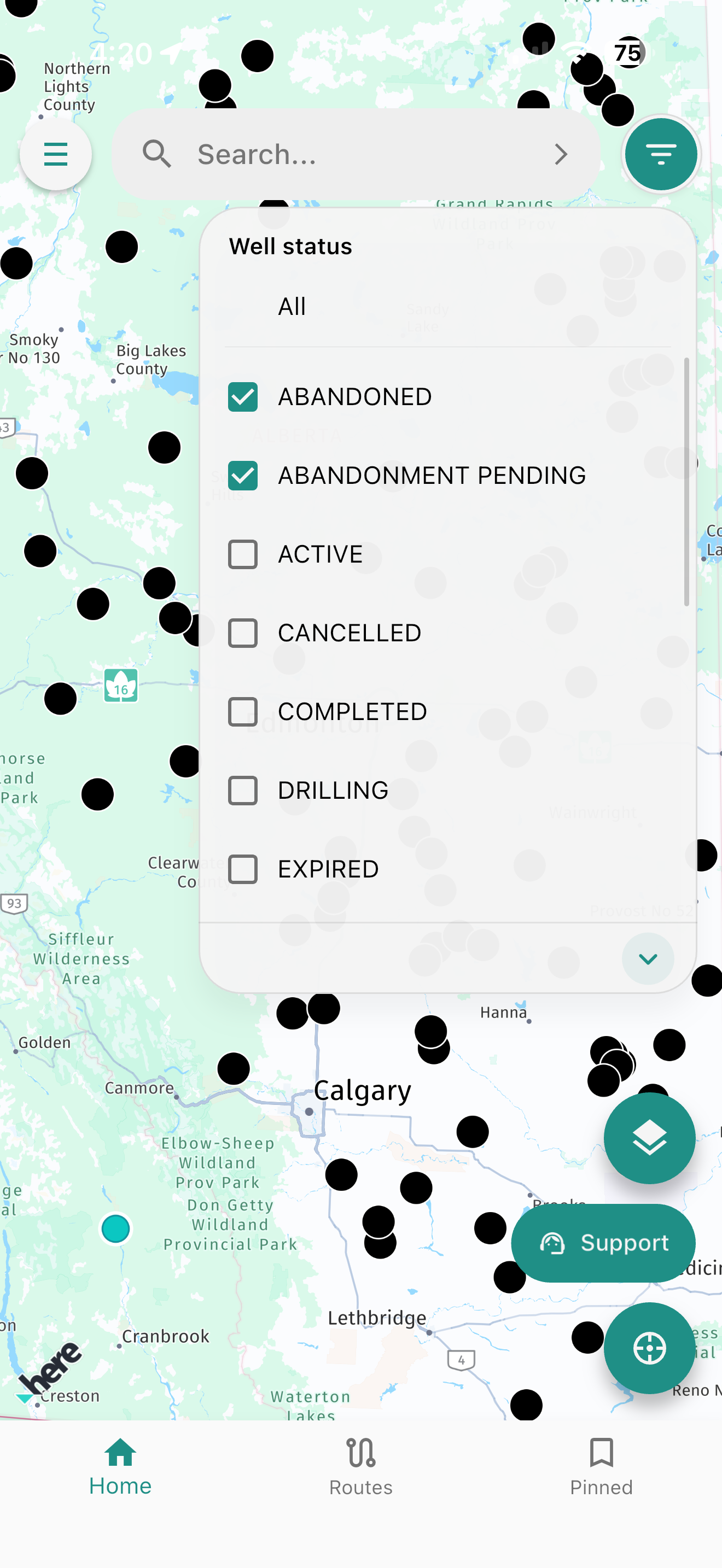
Well status filters will be live this week in Oilfield Route App. Tap the filter button, pick the statuses you care about, and the map clears down to just those wells.
What the filter does
The filter button sits at the top right of the map, beside the search bar. Tapping it opens the Well status panel with a checkbox for every status in our data — ABANDONED, ABANDONMENT PENDING, ACTIVE, CANCELLED, COMPLETED, DRILLING, EXPIRED, and the rest of the list below.
Check the ones you want. The map redraws to show only those wells. Uncheck them, or select All, and everything comes back.
That is the whole feature. No setup, no new screen to learn, no separate list to maintain. It is one tap between the map you have now and the map you actually need.
Why this matters on a run
A cluttered map is not just an eyesore. It costs you time at the worst possible moment — parked on a lease road, engine running, trying to work out which of the six pins in front of you is the one on your ticket.
Filtering by status fixes that in the situations crews described to us most often:
- Abandonment and reclamation work. Filter to ABANDONED and ABANDONMENT PENDING and your map becomes a work list. Everything still producing drops away.
- Service and production runs. Filter to ACTIVE and you are looking at wells that can actually be worked today, not wells that stopped producing three years ago.
- Drilling and completions support. DRILLING and COMPLETED together give you the current program in the area without the historical clutter around it.
- Land and regulatory checks. CANCELLED and EXPIRED pull up exactly the licences you need to confirm, and nothing else.
Your selection stays applied while you pan and zoom, and it works alongside the tools you already use — search by well name, well identifiers, or land description, and the satellite, street, and hybrid views under the layers button.
How to use it
- Open the map and tap the filter button at the top right of the screen, to the right of the search bar.
- Choose your statuses. Check the ones relevant to your work. Select All any time you want the full picture back.
- Close the panel and drive. The map keeps only the wells you selected, so what you see on screen is what you are actually going to.
Included on Essential and Pro Subscriptions
Well status filters are included on both subscription tiers at no extra cost — Essential and Pro, on iOS and Android. If you are already a subscriber, update to the latest version from the App Store or Google Play this week and the filter button will be waiting on your map.
Install it now and keep routing when the signal drops
Choose your device, download the regional map package for your operating area, and head out with offline routing ready before you lose coverage.
Keep the feedback coming
This feature exists because custonmers told us it should.
That is how we would like to keep building. If there is something in Oilfield Route that gets in your way, or something missing that would save you a trip, tell us. The Support button on the map is the fastest route to our team, and every message gets read by people who can do something about it.
Filtering by status was near the top of that list. We would like to know what is next on yours.
Review the core features, compare subscription options, or ask the team a question.